
Krabi River: A Practical Guide to the Estuary, Waterfront and Boat Trips

The Krabi River is short: about five kilometers of main channel that carries a much bigger estuary out to the Andaman Sea. That scale is the key to planning a visit, because walking the Krabi Town waterfront and getting out onto the water are two very different outings. This guide covers where the river sits in town, how to reach it, what you actually see from the bank, how long to allow, and how to ask the right questions before you board a boat.
What the Krabi River actually is
The river itself is only 5 kilometers long and serves as the main channel within a larger estuary that drains into the Andaman Sea. That makes it a tidal waterway rather than a long inland river you would cruise for hours in one direction. What opens up beyond the town is the estuary, a sprawl of channels and flats where three rivers meet.
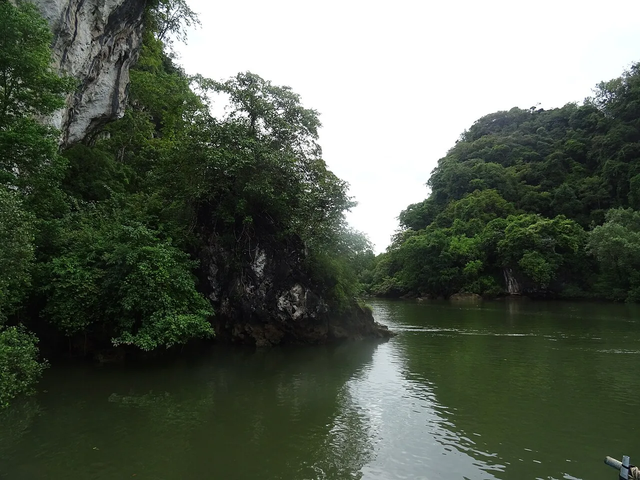
The estuary is enormous relative to the channel: roughly 100 kilometers of mangrove creeks and around 200 square kilometers of tidal flats, protected as a Ramsar wetland since 2001. Knowing that helps you read a boat trip correctly, since most of what you cover will be creeks, flats and mangrove edges rather than a single straight river run. Trips differ mainly in how far into that system they go.

Where it sits in Krabi Town
The waterfront runs along the edge of downtown Krabi Town, and the working side of it clusters near Klong Ji Lard Pier, where the Customs and Harbour Department offices sit. If you are staying in the town center, you can reach the riverside on foot; from hotels farther out, a short tuk-tuk or Grab ride gets you there. The old immigration office has moved out of the center to Tharuea Road Sai Tai beside the Marine Police office, so do not navigate by outdated maps.
Several marinas and moorings sit along this stretch, including Krabi Marina just south of the main town and Port Takola Marina opposite the Klong Ji Lard Pier. These are boat facilities, not visitor attractions, so treat them as landmarks for orientation rather than stops. A third, Krabi Boat Lagoon Marina, is well east of town and not part of a waterfront walk.
How to arrive
Walking is the simplest way in from central Krabi Town: head for the river and follow the road that runs beside it. For a hotel farther out, a tuk-tuk or a Grab ride to the waterfront is short and cheap compared with a day trip to the coast. There is no single official gateway, so ask your driver for Klong Ji Lard Pier as a clear reference point.
If you are coming from the beach side of the province, note that Ao Nang and Laem Nang are a road transfer away, not a stroll, and the Krabi Town waterfront is a separate trip from the piers serving the islands. Domestic flights land at Krabi airport, and the town has benefited from that airport access and a newer ferry jetty, but confirm current transfer options locally rather than assuming a fixed shuttle.
The riverside walk
The Krabi Town river walk measures about 1.8 miles, gains roughly 32 feet of elevation and is rated easy, taking somewhere between half an hour and an hour. In practice, budget about an hour so you can stop for photos and river traffic without rushing. It is flat ground, so heat rather than terrain is the limiting factor.
Do not expect a signed, lit promenade with facilities along its whole length; treat it as a route along the waterfront rather than a managed park. Go early or late to avoid the middle-of-day heat, and carry water. If you want more than a walk, the river can be paired with a temple stop in town such as Wat Kaew Korawaram, which sits in the same central area.
What you see along the way
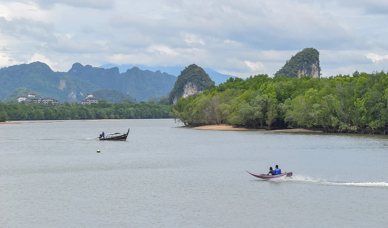
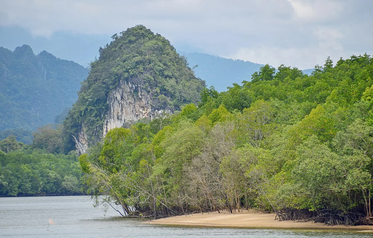
Expect working river scenery rather than a scenic esplanade: piers, moored boats, river traffic and mangrove-fringed water at the edges. The distinctive limestone karsts that frame Krabi Town, including Khao Khanab Nam, are part of the view from the water side and are often the backdrop people photograph. The confluence of rivers feeding the estuary is what gives the water its shifting, tidal character.
Across from town, Koh Klang sits in the river and is reached by boat, giving a different perspective on the estuary than the town bank does. If you are building a half day around the water, a short crossing plus the waterfront walk covers more ground than either alone. Keep the two separate in your planning, since one needs a boat and the other does not.
The Ramsar wetland and why it shapes boat trips
The protected wetland is the reason boat trips out of Krabi Town look the way they do: long, low runs through mangrove creeks and across tidal flats rather than a straight line to a beach. Because the system of creeks and flats is so large, operators cover only a slice of it in a half day. Ask before booking which creeks or channels the route enters, and whether the boat spends its time in the mangroves or heads toward open water.
Boats leave from the Krabi Town waterfront and jetty area, and longtails are the typical way onto the water. Fares, departure times and route inclusions are not published in any consistent form, so agree the route and the total price in Thai baht with the operator before you step aboard. That single conversation prevents most misunderstandings.
Tides and timing
The river is shallow in places, and the approach to town is tidal: one popular anchorage in front of downtown Krabi is accessible only at high tide, while another farther from the center works at all tides. For a passenger on a longtail this matters less than for a yacht, but it still shapes when boats can move through the mouth and which creeks are passable. If a departure time seems odd, tide is usually the reason.
When you arrange a trip, ask the operator directly what the tide is doing that day and whether the route changes; this is more reliable than any fixed schedule you might find online. Do not plan a low-tide departure and assume it will run as advertised. The waterfront walk, by contrast, is unaffected by tides.
Eating and drinking by the river
The River Restaurant and Bar describes itself as the only floating restaurant in Krabi Town, serving fresh seafood and Thai dishes with live music every night, and it opens at 11:30 daily. Those are the restaurant's own published claims, so treat the floating setting and the nightly music as the draw and confirm the rest on arrival. It works well as the endpoint of an evening walk along the water.
Menu prices, dish names and seating are not published in a form you can plan around, so check the menu and the bill before ordering. Nearby, a hotel such as Krabi River Hotel offers a riverside base with a restaurant and terrace if you want to stay close to the water. For a broader set of options in town, browse the full guide to Krabi Attractions: 10 Visitor Guides.

How long to allow
Give the waterfront walk about an hour, and add another two to three hours if you take a longtail into the estuary, plus time to negotiate the trip. A comfortable half day covers the walk, a boat run and a meal by the river without rushing. If you only have an hour, walk the town bank and skip the boat rather than squeezing both.
If you are in Krabi mainly for the beaches and islands, the river is a good low-effort add-on rather than a headline day. Pair it with a temple morning or a beach afternoon rather than trying to fit it around a full-day island trip, since the timing of boat departures will otherwise clash.
Practical notes
The heat through the middle of the day is the main practical constraint on the waterfront, so plan the walk for the morning or late afternoon. There is no published ticket, opening time or closure schedule for the river or the public waterfront, so confirm any boat arrangement and restaurant hours directly before you go. Keep one check of current details for the day of your visit.
Do not rely on the river for swimming; it is a working, tidal waterway and the sources do not describe it as a swimming spot. Treat the waterfront as a place to walk, eat and board a boat.
Nearby options to pair with a river visit
Ao Nang and Laem Nang are the beach-side anchors of the province and are a road transfer from town, while the Krabi archipelago piers serve island trips. Railay Beach, Krabi is reached by boat rather than road, so it belongs in a separate day from a town river walk. Plan the river for your town day and the coast for another.
Inland, Wat Tham Sua (Tiger Cave Temple), Krabi is a well-known temple stop that pairs naturally with a morning in town before an afternoon by the water. Nopparat Thara Beach, Krabi is another coastal option if you are based on the Ao Nang side and want a quieter shoreline. Pick one inland and one coastal add-on so the river stays the focus of its own day.
Is the Krabi River worth an hour of your trip?
Yes, if you want a working-waterfront view of Krabi Town rather than another beach. The 1.8-mile walk fits comfortably into an hour and costs nothing, and it gives context to the estuary you will cross on any boat trip later.
Skip it if your itinerary is already full of islands and your only free time falls in the middle of the day. If you do go, walk early or late, agree any boat route and price in Thai baht with the operator first, and end with a riverside meal at The River Restaurant and Bar.
Explore more Krabi guides
Frequently Asked Questions
Can you walk along the Krabi River from Krabi Town?
Yes. A riverside route of roughly 1.8 miles runs along the Krabi Town waterfront, is flat and easy, and takes about half an hour to an hour at a relaxed pace. It is a working waterfront rather than a maintained promenade, so plan around the heat and carry water.
Do you need a boat to see the Krabi River estuary?
A boat is the only practical way to get into the mangrove creeks and tidal flats beyond town. Longtails leave from the Krabi Town waterfront, but routes and fares are not consistently published, so agree the route and total price with the operator before boarding.
What is the Krabi River known for?
It is a short main channel, about 5 kilometers, inside a much larger estuary that opens to the Andaman Sea. The surrounding wetland, with roughly 100 kilometers of mangrove creeks and about 200 square kilometers of tidal flats, has been Ramsar-protected since 2001, which is why boat trips focus on creeks and flats.